
The Cadastre of Orange is an ancient plan that shows the Roman centuriations (land distributions) that extended across the territory of the colony of Arausio (modern-day Orange in France) in Gallia Narbonensis, as well as across the territories of neighboring cities and colonies. Excavations carried out between 1949 and 1952 near the ancient theater of […]
Plans
Posted inMiddle Ages
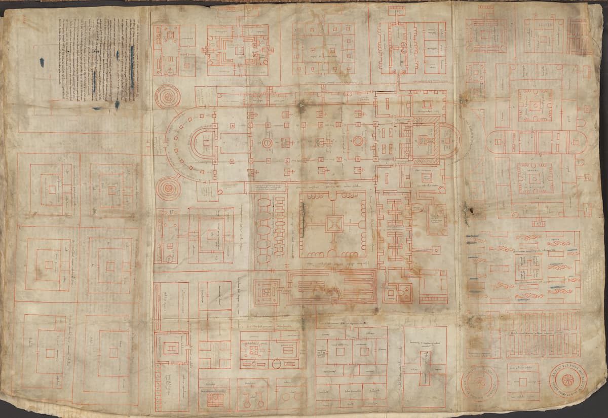
The plan of Saint Gall, the largest known architectural drawing of the High Middle Ages that was never built
The abbey of Saint Gall ( Sankt Gallen in German) was founded in the year 613 in the town that today bears his name in Switzerland by an Irish monk, Gallus of Hibernia. It would be one of the main Benedictine monasteries in Europe for many centuries. It flourished under the patronage of Pepin the […]